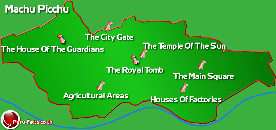
Map of Machu Picchu
Below is a map of Machu Picchu which is located 70km Northwest of Cuzco the former capital of the Inca civilisation. Machu Picchu is 2,430 meters above sea level and is situated on a ridge in the Andean mountain region. There is a vertical dividing line to the Machu Picchu site that separates an agricultural area to the left of the 'City Gate' and an urban area to the right of the 'City Gate'. The agricultural section enables you to get an insight into the farming terraces the Inca people used and how self sufficient they were. The urban sector contains gives you the oppourtunity to look at the constructions built by the incas and the quality that the buildings are made with, especially considering that the area was built in 1450AD which makes Machu Picchu an incredible achievment.
Areas of interest include 'The Temple of the Sun' which is a round tapered tower. The stonework of this temple is some of the finest in the city, outlining its importance. In the center of the temple is a carved rock with a straight edge. During the Summer solstice, this edge will precisely align with the light falling through the only window of the temple. Below the the temple of the sun you can find 'The Royal Tomb' where the remains of Inca royalty was found upon discovery of Machu Picchu.